Key takeaways
- 3D mapping records what exists across a site; 3D modeling renders specific objects for design and BIM.
- Relative accuracy matters for measurements like roof area or stockpile volume; absolute accuracy matters when coordinates must match real-world GPS.
- Drone-captured data delivers reliable results for either need, faster and more efficiently.
In the last few years, drone technology has become more advanced. As a result, drone mapping has become more accurate and useful to companies of all kinds. But how does it differ from modeling? Are there particular benefits to using one over the other? Here are some key reasons why 3D drone mapping is different than 3D drone modeling. Contact us to learn more
3D Modeling Vs 3D Mapping
While there is some overlap between the two, they meet different needs. 3D Mapping is a precise image of terrain including all the buildings
and natural structures present in the map and typically applies to a larger area. It shows size, depth, and is often combined with other
data to create industry-specific information used as a tool for project planning and resource management. 3D modeling, on the other hand,
is better used for detailed renderings of specific objects, or smaller areas that can be turned into real-life models of
buildings and large infrastructure. They have more commercial purposes for architectural planning and BIM (Building Information
Modeling).
Accuracy
Drones use ground control points to increase their accuracy. There are two types of accuracy to understand when it comes to 3D drone mapping. Relative (or local) accuracy is the degree given on a map relative to other points within that map. This means if a distance measures say 10 inches, it measures as 10 inches in both the real world and on the map. Absolute (or global) accuracy, on the other hand, is the degree where a point on the map fixes to a coordinate in the real world. Meaning, a latitude, and longitude point on the map will correspond accurately with real GPS coordinates. Your project will require different levels of accuracy and depending on your needs, you’ll be able to find the right one for your desired output.
Relative Accuracy
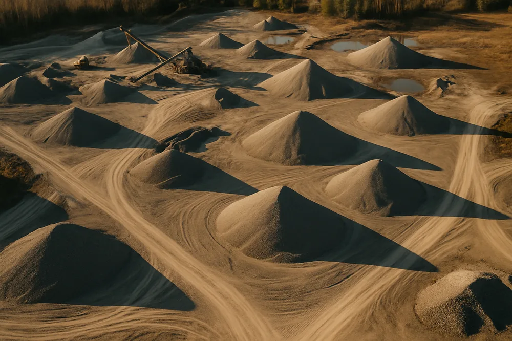
Relative accuracy is of greater importance in 3D drone mapping when real world measurements are being extracted from the data and it is required that the values returned match the actual measurement the model represent. A typical application would be a construction project where the square footage of a roof is measured for calculating how many shingles would be required or when measuring the volume of a large stockpile so that accurate inventories can be recorded. The location of the roof and stockpile is irrelevant, all that is needed is an accurate measurement of the surface, or material.
Absolute Accuracy
Absolute accuracy in 3D drone mapping refers to the degree of confidence you have in your latitude, longitude, and elevation accuracy in the dataset. When a coordinate in the rendered 3D model must correspond with the real-world coordinate it represents, a high degree of absolute accuracy is required. A typical example would be an elevation map, or slope calculation at an open pit mine where critical decisions are made using the generated model.
Reap the Benefits
Regardless of the requirements, drone captured data can provide the solution to benefit your project. 3D Drone Mapping has a high level of reliability whether you need relative or absolute accuracy, and delivers the results more efficiency. Give us a call today,we are always interested in discussing new projects and answering any questions you may have.