Key takeaways
- Drone-captured data brings real-world accuracy to construction, BIM, and 3D modeling.
- Aerial inspection and stockpile measurement cut cost, risk, and downtime.
- Single-flight projects are routine — pricing scales with the deliverable.
In recent years, drones have been proven to offer a wide variety of benefits to various industries. Here are just a few benefits to using commercial drone services for your business. Contact us to learn more.
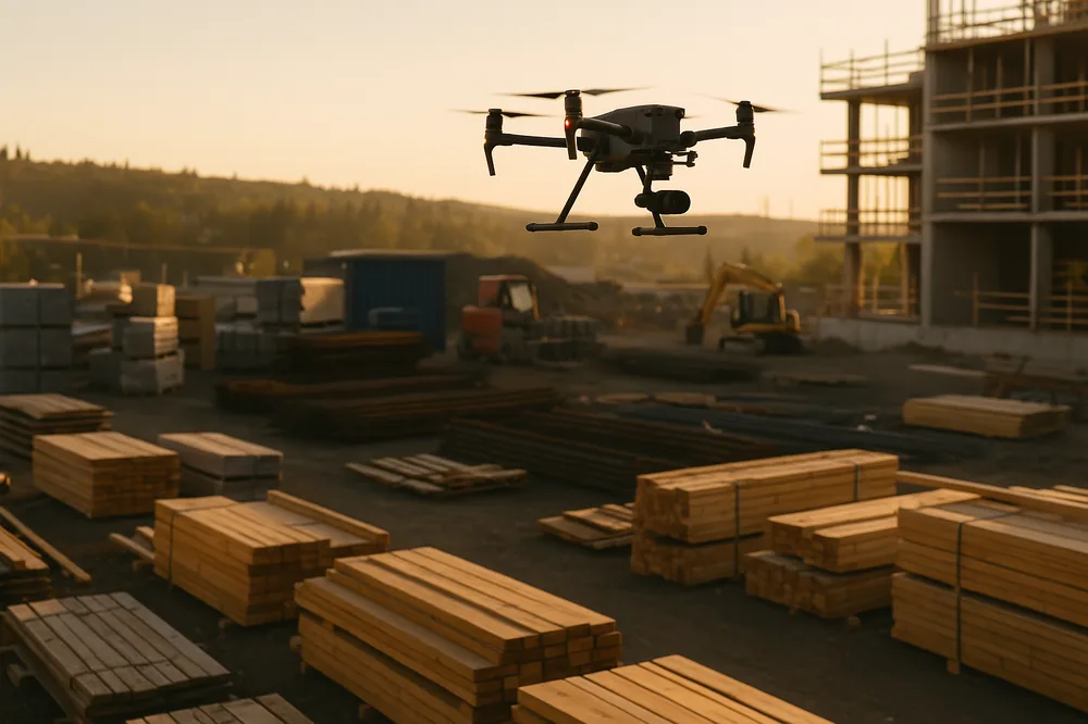
Construction and BIM (Building Information Modeling)
Drone captured data brings a real-world element to building information modeling allowing more efficient planning, design, construction, and management of buildings and infrastructure. By incorporating as-built 3D renderings of on-going construction projects, stakeholders can monitor and document progress using visualizations collected from the actual conditions on the day the data is collected. This can remove some margin for error and increases the accuracy between the planning stage and on-site construction. UAV Imaging Inc. uses Pix4D software exclusively for all our construction and 3D modeling projects. For more information on the Pix4D BIM engine go to the follow link-https://www.pix4d.com/product/pix4dbim
Commercial Inspections
Drones have revolutionized the aerial inspection industry. Airplanes and helicopters are expensive. High climbing can be dangerous and limited. Foot traffic on some materials during an inspection can cause the damage it was meant to detect. Drones can eliminate many of the liabilities associated with the inspection of elevated infrastructure while providing superior image quality and improved efficiency. Incorporating commercial drone services in your inspection process can be the difference between early detection, or a costly defect repair with associated downtime.
Stockpile Measurement
Ground-based methods of measuring a stockpile can be dangerous and inefficient. Why risk injury climbing a massive pile of loose aggregate to manually capture each point used for modeling? 3D rendering of stockpiles built using drone captured imagery yields an exponential increase in data points and does it in a fraction of the time. The increase in points ensures every contour of the pile is included so accuracy and safety are improved by an order of magnitude that is easy to quantify.
Mapping, Reclamation and Pit Plans
Commercial drone services in the capture of imagery for mapping, reclamation and pit planning is rapidly becoming the industry standard. Drones can be quickly deployed to remote locations to capture low altitude imagery for the creation of high-resolution maps and surface models. This helps government agencies and industry make critical decisions for resource management and regulatory requirements. A drone can be outfitted with a multitude of payloads and multispectral cameras to provide detailed typographical data in a variety of environmental conditions. Their versatility and relative low-cost to traditional aircraft make drone deployment the most cost-effective option for large area data acquisition.
Start Benefiting from Commercial Drone Services Today!
Commercial drone services are a cost-effective way to elevate your business. Let us take your business to new heights with our aerial imaging, video and mapping solutions.