Key takeaways
- One Matrice 400 flight can survey a full pit without shutting the site down.
- Zenmuse L3 LiDAR delivers 3 cm horizontal and 4 cm vertical accuracy with up to 16 returns per pulse.
- D-RTK 3 gives 1 cm positioning, so stockpile volumes hold up for finance and audits.
Aggregate operators are quietly retooling how they survey pits, measure stockpiles, and manage active faces. A new generation of DJI platforms covers more ground per flight, captures survey-grade LiDAR, and positions to the centimeter, which turns drone work from a novelty into a routine part of the operation.
Here is what the latest hardware brings to a working pit or quarry, and what it changes on the ground.

Why aggregate sites are going airborne
Manual stockpile surveys mean someone walking the slopes with a GPS rover, often while the site keeps moving around them. Drone capture replaces that with a single overhead pass that is faster, safer, and repeatable month over month for inventory reconciliation.
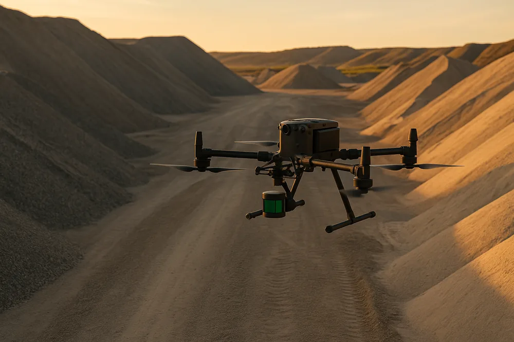
DJI Matrice 400: more coverage, fewer landings
The Matrice 400 is the workhorse airframe, built for endurance and rough conditions:
- Long flight time per battery, enough to cover a full pit in one mission
- 40 km operational range and a 6 kg payload capacity
- Weatherproofed for operation in rain and dust around active sites
- Supports advanced payloads including LiDAR
Longer flights mean fewer battery swaps and landings, which is the difference between surveying a site in one window versus stretching it across a shift.
Zenmuse L3: survey-grade LiDAR for stockpiles and topography
The Zenmuse L3 is an integrated LiDAR and high-precision imaging payload built for measurement work:
- System accuracy of 3 cm horizontal and 4 cm vertical
- Detection range to 500 m and up to 16 returns per pulse for terrain penetration through cover
- Dual 100 MP RGB cameras for photogrammetry alongside the LiDAR
Up to 16 returns means the laser reaches the ground between vegetation and across irregular stockpile surfaces, so the volume reflects the real pile rather than the canopy. That accuracy is what makes the numbers defensible for finance and audit.
DJI D-RTK 3: centimeter positioning without ground control
Accurate volumes need accurate positioning. The D-RTK 3 mobile station anchors every capture:
- 1 cm + 1 ppm positioning precision
- Relay range up to 12 km and multi-aircraft sync for large sites
- Over 7 hours of battery life across a full survey day
With RTK positioning you skip laying extensive ground control points, the slowest part of a traditional survey, and still hold centimeter accuracy across the site.
DJI Agras T100: dust suppression, seeding, and site logistics
Aggregate work is not only measurement. The Agras T100 is a heavy-lift application drone that handles the messier jobs:
- 100 L liquid tank and 150 L spread tank with a 13 m application width
- Up to 100 kg lift capacity for site logistics
- LiDAR, radar, and vision-based terrain following with obstacle avoidance
On a pit that means targeted dust suppression on haul roads, reclamation seeding on finished benches, and moving material to spots a truck cannot easily reach.
What this means for your operation
Put together, the latest drone hardware changes three things at an aggregate site:
- Faster cycle counts: a full survey in one flight instead of a crew day on the slopes
- Safer operations: nobody walking active faces or climbing stockpiles
- Defensible volumes: survey-grade LiDAR plus RTK positioning produces numbers finance and auditors can stand behind
UAV Imaging runs this class of equipment across Alberta. If you operate a pit or quarry, the practical question is no longer whether drones can do the work, but how much faster and safer your next survey could be.