Key takeaways
- RTK corrects positions in flight; PPK corrects them after, from raw logs.
- RTK is faster and link-dependent; PPK works anywhere and keeps a re-processable audit trail.
- Either way, independent ground control points are the non-negotiable QA check.
Stockpile reports, pit plans, and as-built mapping all live or die on accuracy. The two technologies that deliver cm-grade accuracy on a commercial drone — RTK (Real-Time Kinematic) and PPK (Post-Processed Kinematic) — get conflated in casual conversation, but they solve the problem in meaningfully different ways. Pick the wrong one for a job and accuracy collapses or budget bloats.
Here is the breakdown clients keep asking for, written for project managers and survey leads, not just GIS staff.
What RTK and PPK actually are
Both are GNSS techniques that correct the noisy raw positions reported by satellites against a known reference. A standalone consumer GPS chip is accurate to about 3-5 metres. RTK and PPK both bring that down to 1-3 centimetres. They differ in when the correction happens.
RTK — corrections in real time
Real-Time Kinematic sends correction data from a base station (or a cellular NTRIP service like SmartNet or CanNet) to the drone during the flight. The drone's GNSS receiver applies the correction on the fly and writes corrected coordinates into the image EXIF as each photo fires. Result: corrected geotags before the drone lands.
PPK — corrections after the flight
Post-Processed Kinematic logs raw GNSS observations on the drone alongside raw observations from a nearby base station. The two logs are aligned and corrected in software (RTKLib, Emlid Studio, vendor tools) after the flight. Image EXIF gets updated, and processing continues into the photogrammetry pipeline.
Side-by-side comparison
| Property | RTK | PPK |
|---|---|---|
| Correction timing | In flight | Post flight |
| Typical horizontal accuracy | 1-3 cm | 1-2 cm |
| Reliance on data link | Cell signal or radio modem mandatory | None — logs offline |
| Remote sites | Fails outside coverage | Works anywhere with a local base |
| Robustness to dropouts | Brief dropouts degrade results in flight | Dropouts are reconstructed in software |
| Field time | Faster — done at landing | Adds 15-30 min office processing |
| Office-side complexity | Low | Medium — needs processing software + skill |
| Hardware requirement | RTK-capable drone + base or cell modem | PPK-capable drone + raw-logging base station |
| Audit trail for QA | Single in-flight position record | Re-processable raw logs preserved |
Where each one wins
Choose RTK when
- The site has reliable cell signal or you can set up a local base + radio link
- Crew time is the bottleneck — RTK skips post-processing
- You need positioned data immediately at landing for live QA
- The job is routine inventory work where a single accuracy spec is acceptable
Choose PPK when
- The site is remote: no cell signal, no line of sight to a base station radio
- The flight is long, BVLOS-style, where in-flight correction would be lost mid-flight
- You need a re-processable audit trail (raw logs survive)
- You want the highest accuracy possible — PPK is typically 0.5-1 cm tighter than RTK on the same hardware
- The deliverable is for a survey-of-record context where every centimetre is justified to a regulator
UAV Imaging's standard setup
The DJI Matrice 300 RTK in the UAV Imaging fleet supports both modes. The default workflow:
- RTK in real time via Alberta SmartNet cellular NTRIP for sites in cell coverage
- PPK fallback with a local base station (Emlid Reach RS+) for remote sites, BVLOS pipeline runs, or any job where the deliverable needs a re-processable record
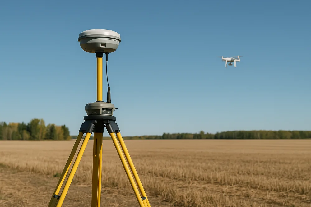
Ground control points (GCPs) — typically 5 to 10 across a 50-hectare site — are surveyed regardless. GCPs are the independent check on whatever GNSS method ran. Without GCPs, neither RTK nor PPK can be audited.
Common misunderstandings
"RTK alone gives me survey-grade accuracy"
RTK gives positioning accuracy to 1-3 cm. Survey-grade mapping accuracy depends on the photogrammetry pipeline downstream of positioning. Without GCPs, even perfect RTK can produce a 5-10 cm vertical bias across a site because the camera lever-arm offset and timing latency are not modelled. GCPs catch and correct that.
"PPK is just RTK done later"
Mathematically similar, operationally different. PPK preserves raw observation logs that can be re-processed if the base station is repositioned, or if new IGS orbital data becomes available. RTK keeps only the final corrected position. For long-term archival or audit work, PPK is the better record.
"RTK skips the need for a base station"
Only if you use a cellular NTRIP service. If the network is down or out of coverage, RTK falls back to standalone GNSS (3-5 m). A local base + radio link is the failover. UAV Imaging carries both.
Bottom line for Alberta operators
For aggregate yards, construction sites, and solar farms in cell-served areas, RTK over Alberta SmartNet is the practical default — fast, simple, well-supported. For remote pipeline corridors, alpine sites, or any job where the deliverable will be cited in a regulatory submission, PPK with a local base earns the extra office time.
The non-negotiable in both cases is independent GCPs as the QA check. Anyone selling cm-grade drone mapping without GCPs is selling a positioning claim, not a mapping claim.