UAV Imaging covers Grande Prairie and the wider Peace Region with an industrial drone-services menu built for the work that actually drives the local economy: natural gas gathering and processing, forestry, agriculture, aggregate, and the heavy-civil construction that supports all of it. Crews dispatch from Edmonton and stage multi-day deployments out of Grande Prairie for larger scopes.
Services available in Grande Prairie
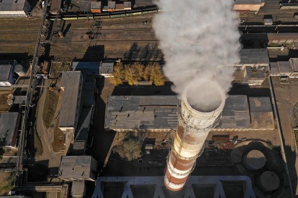
- Drone inspection services — flare stacks, vent stacks, gas-plant structural steel, gathering lines, transmission and distribution towers
- Aerial methane survey — gas gathering systems, well pads and plant sites with the Pergam Falcon on a Matrice 300 RTK (supports AER Directive 060 leak programs)
- Drone mapping & pit plans — gravel-pit progression, overburden volume, haul-road as-built
- Drone stockpile measurement — aggregate, sand and gravel volume reports for Peace Region pits
- Drone construction services — lease and pad construction, plant turnaround documentation, capital-project progress
- Forestry & ROW mapping — cutblock survey, reforestation documentation, pipeline and powerline right-of-way vegetation tracking (LiDAR available for canopy penetration)
Industries served around Grande Prairie
- Oil & gas — Montney gas gathering, processing plants, flare and vent stacks, compressor stations, methane survey
- Forestry & pulp — cutblock and reforestation survey, road planning, ROW vegetation mapping
- Agriculture — Peace Country crop scouting, drainage planning, multispectral health mapping
- Aggregate & gravel — pit volumes, bench geometry, reclamation documentation
- Heavy civil & construction — lease builds, road and pad progress, drainage and earthworks volumes

Service area
UAV Imaging works Grande Prairie proper and the surrounding Peace communities — Sexsmith, Clairmont, Wembley, Beaverlodge, Hythe, Grovedale, Valleyview, Fox Creek, Fairview, Spirit River and the gas-plant and lease corridors in between. Edmonton-based dispatch with multi-day Grande Prairie staging for larger scopes.
Why hire a drone operator familiar with Peace Region work
The Peace Region mixes Montney gas infrastructure, active forestry tenure, broad-acre agriculture and gravel operations — each with its own access, scheduling and compliance reality. Gas-plant and well-pad work carries contractor-management requirements (ISN, ComplyWorks, Avetta) and turnaround pressure; the controlled airspace of the Grande Prairie Airport (CYQU) zone needs coordination; cold-weather windows are real. UAV Imaging arrives with the certifications, the fleet (Matrice 300 RTK + H20T + Pergam Falcon + LiDAR) and the SORA experience that match the deliverables Peace Region operators actually buy.
Compliance and credentials
- Transport Canada Advanced RPAS certified pilots on every flight
- $5M aviation liability insurance (above the 2026 $2M minimum)
- ISN, ComplyWorks, Avetta registered — standard for gas-plant and lease access
- Site-Specific Operations Risk Assessment (SORA) on higher-risk operations
- 2026 Remote ID compliant fleet
- Cold-weather operations to roughly -25°C (Matrice 300 RTK envelope)