Key takeaways
- In June 2026 Health Canada's PMRA issued an interim Letter of No Objection opening a narrow pathway for applying aerial-registered pesticides by drone, ahead of the final PRO2026-01 rule.
- It is not a blanket approval — Transport Canada aviation rules and provincial applicator licensing still apply.
- UAV Imaging does not spray. Our role is the data layer: NDVI and multispectral imaging that shows where treatment is warranted.
For years the headline question in Canadian agricultural drone circles was whether regulators would ever let drones spray crop protection at all. As of June 2026, the answer moved from "proposed" to "starting, on an interim basis." It is a milestone worth understanding even if you never spray a field — because it is the clearest signal yet of how quickly Canada's Remotely Piloted Aircraft Systems (RPAS) framework is maturing.
UAV Imaging is a commercial mapping, inspection, and multispectral imaging company. We do not apply pesticides. But the same regulatory momentum that is opening doors for spray drones runs right alongside the Level 1 Complex Operations and Beyond Visual Line of Sight (BVLOS) changes that shape inspection and survey work. Here is the plain-language version of what happened, and what it means for operators and the clients who hire them.
What actually changed in June 2026
Health Canada's Pest Management Regulatory Agency (PMRA) issued a Letter of No Objection (NoO) to the Canadian Agricultural Drone Association. In plain terms, it opens a narrow interim pathway: a pesticide that already carries conventional aerial-application directions on its registered label can be applied by drone under those same directions, while the broader regulatory proposal — PRO2026-01 — is still being finalized.
This sits on top of the proposal PMRA put out for consultation earlier in 2026. That consultation closed in late March, and the June Letter of No Objection is the interim bridge while the final rule is written. It is not a blanket "spray anything by drone" approval. The product has to already be registered for aerial application, the registrant must not have opted it out, and every other rule still applies.
The path from proposal to practice
Why a pesticide rule matters to imaging operators
It is tempting to file "drone spraying" under "not my department" if you fly survey and inspection missions. But the spray file is a useful barometer. The regulators moving here — Health Canada on the chemistry, Transport Canada on the airspace — are the same bodies steadily expanding what commercial RPAS operators can do. The Level 1 Complex Operations pathway that is reshaping BVLOS inspection and mapping work and the spray-drone pathway are two streams of the same maturing framework.
There is also a practical client angle. Operators who work with agricultural and land-management clients are increasingly expected to understand the whole RPAS picture, not just their own service line. Being able to explain where the rules actually stand — interim pathway, not blanket approval — is part of being a credible operator.
The imaging layer underneath every spray decision
Here is where the two worlds genuinely connect. A spray pass is only as good as the decision behind it: where to treat, and whether to treat at all. That decision is a data problem, and data is exactly what imaging delivers.
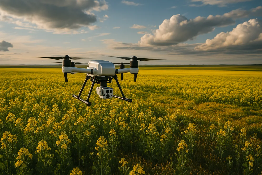
Multispectral NDVI imaging surfaces crop stress, disease, and weed pressure before it is visible to the eye — often two to three weeks early. That map tells a grower or agronomist exactly which zones warrant a treatment, so any application — ground rig, fixed-wing aerial, or eventually a drone — is targeted rather than blanket. As drone application moves closer to legal reality, the value of a clean, georeferenced "where is the problem" map only goes up.
In other words: imaging tells you where and whether; application handles how. The June news strengthens the case for the first half of that equation regardless of who eventually flies the spray.
What is still pending
The interim pathway is real, but it is narrow. The final PRO2026-01 rule is still expected later in 2026, and trade coverage from outlets like the Manitoba Co-operator has flagged open questions around water volumes and droplet size at smaller payloads. On the aviation side, Transport Canada certification and any required Special Flight Operations Certificate are unchanged. And provincial applicator licensing continues to apply to whoever is responsible for the spray.
For the full proposal text, Health Canada's PRO2026-01 consultation page is the primary source.
How UAV Imaging fits
We stay in our lane, and our lane is data. UAV Imaging holds Advanced RPAS certification across all pilots, carries $5M aviation liability, flies a Remote ID-compliant fleet, and delivers multispectral, thermal, and high-resolution mapping products. For agricultural and land clients, that means defensible, georeferenced imagery that informs decisions — including, increasingly, where a treatment is and is not warranted.
We will keep watching the regulatory file and update this page as PMRA publishes the final rule.