Key takeaways
- Most winter work runs -10°C to -20°C with battery preheat; below -25°C is a no-fly.
- Fresh snow defeats photogrammetry feature matching unless you raise overlap and pre-place high-contrast GCPs.
- Stage the aircraft outside the warm truck for 8-10 minutes so optics do not fog at launch.
Alberta winters do not stop commercial drone work — but they change it. Battery endurance shrinks. Photogrammetry behaves differently over snow. Optics fog when warm aircraft meets cold air. Knowing the envelope and where it bends is the difference between a useful winter survey and a wasted day in the cold.
This is the field-tested guide UAV Imaging crews use when scoping cold-weather projects across the province.
The operational envelope
| Temperature | Operational status | Considerations |
|---|---|---|
| 0°C to -10°C | Normal operations | Battery endurance 10-15% lower than summer |
| -10°C to -20°C | Operations with preheat | Pre-warm batteries to 15°C; reduce flight legs by 30-40% |
| -20°C to -25°C | Marginal — case by case | Insulated battery pouches required; calibration warm-up extended |
| Below -25°C | No-fly | Battery cell voltage sag exceeds manufacturer specs; aborted |
The DJI Matrice 300 RTK is rated to -20°C, the Mavic 3 Enterprise to -10°C. UAV Imaging conducts most winter work between -10°C and -20°C with battery preheat and shortened flight legs.
1. Battery management is everything
Lithium-polymer batteries lose capacity in cold. A 5,935 mAh TB60 battery on the Matrice 300 that delivers 55 minutes of hover at +25°C delivers about 38-42 minutes at -15°C. Cell voltage sags faster under load, and the flight controller commands an early return-to-home once any cell drops below safe limits.
Crew procedure:
- Batteries stay in heated truck cab during transit and between flights
- Self-heating mode engaged 5-8 minutes before installation
- Insulated battery pouches used between truck and aircraft
- Flight legs reduced 30-40% from summer baseline; budget more battery swaps
- Voltage telemetry monitored continuously, not just before launch
2. Snow + photogrammetry
Fresh snow is white, low-contrast, and reflective. Three things happen to a photogrammetry capture:
Feature matching collapses
Structure-from-Motion needs distinct, repeatable features across overlapping photos. Over uniform snow, every patch looks like every other patch. The model fails to converge. Mitigation: increase overlap from 80/70% to 90/85%, fly lower for finer ground sample distance, and ensure ground control points are pre-placed with high-contrast targets before snowfall — a printed black-on-white panel disappears under snow.
Exposure is hard
Snow lifts metering. Default auto-exposure underexposes the scene, blowing out detail. Crews lock exposure manually before takeoff and bracket on bright days.
Surface changes visibly between flights
Comparing a snow-covered ortho to an unsnowed baseline ortho shows wholesale colour change. For progress comparisons, schedule winter flights consistently — all snow-on or all snow-off, never mixed.
What still works in winter
Stockpile volumes — provided the pile shape is captured cleanly with GCPs and the snow layer is consistent in thickness across the pile. Many Alberta gravel pits prefer winter flights specifically because snow renders pile geometry more visible than dust-coated summer surfaces.
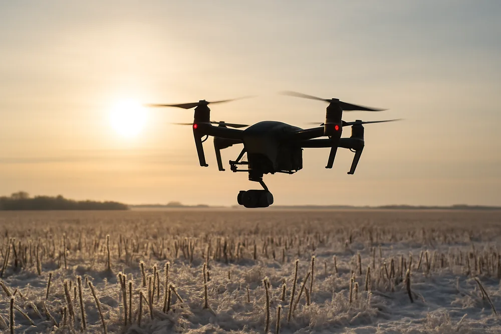
3. Optics fog when warm meets cold
A drone stored in a heated truck cab and walked out to a -15°C launch site will instantly condense on every glass surface. Lens, gimbal cover, thermal sensor optics — all fog. Flying with fogged optics produces unusable imagery.
Mitigation: stage the drone outside the truck for 8-10 minutes before takeoff. Condensation forms on a warm surface in cold air, not on a cold surface in cold air. Once the aircraft equilibrates, the glass stays clear.
4. IMU + compass calibration take longer
Inertial measurement units self-calibrate during start-up — gyros, accelerometers, magnetometers all reach steady-state. Cold soaks lengthen the warm-up. The Matrice 300 will block arming until the IMU reports ready. Budget 4-6 minutes for the first start-up of the day at -15°C, versus 90 seconds in summer.
If the compass shows interference (common near steel pipeline yards or transformer pads), recalibrate at the worksite, not the office. Magnetic-field gradients differ between sites and a calibration done at +20°C indoors may not hold outdoors at -15°C.
5. Pilot + crew comfort matters more than people admit
Cold hands on tablet controllers lose dexterity. Crews wearing standard work gloves miss touch inputs. UAV Imaging uses capacitive-tip gloves designed for tablet work, and rotates the pilot between flights to keep alertness high. Heated controllers (Smart Controller Enterprise) extend tolerable on-station time meaningfully.
6. Pre-flight weather check additions
Beyond the usual checks, winter ops add:
- Wind chill (-25°C wind chill at -15°C ambient drops battery life faster than ambient alone)
- Sun angle (low winter sun creates harsh raking shadows that complicate photogrammetry)
- Daylight window (a December flight near Edmonton has roughly 8 hours of usable light)
- Surface conditions (drifting snow can obscure GCP markers or change pile geometry between mapping passes)
Winter use cases UAV Imaging takes on regularly
- Stockpile volumes: aggregate yards under snow cover — accuracy preserved with proper GCPs
- Thermal inspections: winter is the best season for solar farm thermal scans (high panel/ambient delta) and for tank insulation surveys
- Methane surveys: cold air is denser and methane plumes are slower-rising — sometimes easier to detect
- Asset documentation: bare deciduous canopy gives clearer pipeline corridor and transmission line views than summer foliage