

Mine Drone Mapping

aerial view of an open-pit aggregate mine with benches and haul roads

Drone Mapping & Survey for Mines

For mine engineers, surveyors, and operations managers: survey-grade open-pit mapping, plus visual underground and confined-space inspection, across Alberta and Western Canada.

A mine is measured constantly - topography for the monthly survey, volumes for reconciliation, highwalls for geotechnical review, haul roads for maintenance. Drones cover that ground in a fraction of the time of walking a GPS rover across an active pit, and they do it without putting a surveyor on unstable benches or in front of moving equipment. UAV Imaging flies your site and hands back survey-grade data your engineering and operations teams can act on the same week.

We map open-pit and aggregate operations from the air - topographic surfaces, stockpile and cut/fill volumes, highwall and bench geometry, haul-road grades, and tailings and reclamation progress - all georeferenced to your control and datum. Where the work is inside a shaft, stope, ore pass, or bin, a collision-tolerant confined-space drone captures the visual data without sending a person into the hazard. Every flight is run by a Transport Canada-certified crew under our COR and ISN safety program, so we mobilize onto an active site the way your other contractors do.

Mine mapping ties into our wider survey work: see drone mapping & pit plans and stockpile measurement for the aggregate side, our LiDAR surveys where vegetation hides the ground, and the drone-vs-ground survey case study for how the numbers compare.
REQUEST A QUOTE CALL 587-532-9000
Open-Pit Topo & Volumes
Full-pit topographic surfaces and volume reconciliation - stockpiles, cut/fill, and month-over-month movement from repeatable flights.
Highwall & Bench
High-resolution models of highwalls and benches for geotechnical review - captured safely from the air, no one on the crest or toe.
Haul Roads & Tailings
Grade and drainage checks on haul roads, plus tailings and reclamation progress tracked over time against your plan.
Underground & Confined Space
Collision-tolerant drone imaging of shafts, stopes, ore passes, and bins - high-quality visual inspection data (photo and video) captured without a person entering the hazard. GPS-denied flights are inspection-grade, not survey-grade - we are explicit about which is which.

Deliverables & Formats

Orthomosaic

High-resolution site orthomosaic as GeoTIFF.

Terrain models

DSM and DTM as GeoTIFF, tied to your mine grid.

Contours

DWG/DXF at your chosen interval.

Point cloud

LAS/LAZ for engineering and design packages.

Volume reports

Stockpile and cut/fill volumes as CSV/PDF, ready for reconciliation. All deliverables CAD-ready, metric units, NAD83(CSRS).

QA/QC

Accuracy validation against your control, reported with every survey; control coordinates and processing notes on request.

Accuracy & Control

Every survey is tied to real-world control and delivered in your coordinate frame: NAD83(CSRS), UTM Zone 11/12 or your local mine grid, with CGVD2013 (CGG2013 geoid) or HTv2 vertical datums as required. Ground control is optional for reconnaissance-grade work and recommended for engineering deliverables; we accept your existing control and standard target types, and match the realization and epoch of your control network on delivery.

RTK/PPK only
typically 3-6 cm horizontal / 5-10 cm vertical
With ground control points
typically 2-3 cm horizontal / 3-5 cm vertical

Ranges are industry-typical for RTK drone survey on open pit surfaces; site conditions affect results. Achieved accuracy is measured against your control and reported with every delivery - confirmed per project before we fly.

Above Ground and Below

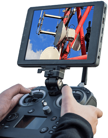
mine survey drone remote

The Right Aircraft for Each Task:

  • RTK survey platform for open-pit topography, volumes, and highwall models - typically centimetre-grade when tied to your ground control, validated per site
  • Collision-tolerant confined-space drone for shafts, stopes, ore passes, and bins - keeps people out of the hazard
  • Repeatable flight lines so monthly surveys and volume reconciliation compare cleanly period to period
  • Deliverables in the formats your team uses - point clouds, DTM/DSM, contours, orthomosaics, and volume reports
  • Georeferenced to your mine grid, coordinate system, and datum
  • Optional LiDAR where vegetation or reclamation cover hides the ground surface
  • Flown by a Transport Canada-certified crew under our COR and ISN Member Contractor safety program

Aircraft and payload selected per site and task. Contact us to confirm the platform for your operation.

Built for active mine sites

Aerial capture keeps your people away from moving equipment and unstable ground while still delivering the data your operation runs on.

Transport Canada Compliant

Every flight is run by a Transport Canada-certified crew under full regulatory compliance for commercial drone operations.

COR Certified + Insured

We are COR certified and fully insured, so we mobilize onto your site on the same safety footing as your other contractors.

ISN Member Contractor

As an ISN Member Contractor, our safety and compliance records are already verified for industrial procurement.

See how aerial survey compared to a ground crew on a live stockpile job →

Need Your Mine Mapped or Inspected?
Rapid mobilization across Alberta - timing confirmed when you book.

How a Project Runs

1

Site orientation

Permits, airspace, and site safety coordination before anyone flies.

2

Control handoff

Your ground control and coordinate system tied into the flight plan.

3

Capture

Flight is typically completed in a day on site, without stopping your operation.

4

Processing + delivery

Volumes and surfaces processed and issued on a schedule confirmed per scope - ask when you book.

Mine Drone Mapping - Frequently Asked Questions

Can you fly on an active mine site?
Yes. We are COR certified, an ISN Member Contractor, and fully insured, and every flight is run by a Transport Canada-certified crew. We coordinate with your site safety and dispatch so aerial survey happens without stopping production or putting people in the pit.
How often can you resurvey for volume reconciliation?
As often as your reporting requires - weekly, monthly, or per campaign. We fly repeatable lines tied to your ground control so each survey compares cleanly to the last for accurate period-over-period movement and reconciliation.
Do you inspect underground and confined spaces?
Yes. A collision-tolerant confined-space drone captures visual data inside shafts, stopes, ore passes, and bins, so you get the imagery you need without sending a person into the hazard. See our confined-space inspection work for examples.
What deliverables do I get?
Point clouds, bare-earth and surface models (DTM/DSM), contours, orthomosaics, and volume reports - georeferenced to your mine grid and datum, in the formats your engineering team already uses.
Is underground drone data survey-grade?
Underground and confined-space flights are GPS-denied, so those missions deliver high-quality visual inspection data - photo and video - rather than survey-grade measurement. Open-pit surfaces flown with the RTK platform and tied to control are measurement-grade. We are explicit about which is which on every deliverable.
What does a typical project timeline look like?
Site orientation and permits first, then control handoff, then capture - usually a single day on site. Processing and delivery run on a schedule confirmed per scope when you book. Insurance certificates, COR and ISN documentation are available on request.

Ready to map your site?

REQUEST A QUOTE

or call 587-532-9000

Related case study
Drone survey vs ground survey on a stockpile →

How aerial capture compared to a conventional ground survey on volume, time, and safety.

Call 587-532-9000Get a Quote