

Drone LiDAR Surveys

colorized drone LiDAR terrain elevation model of Alberta foothills

Survey-Grade Drone LiDAR Across Alberta

For engineers, surveyors, and project managers who need true bare-earth data - not treetops.

When you need bare ground - not treetops - drone LiDAR is the tool. Unlike photogrammetry, a LiDAR sensor fires hundreds of thousands of pulses per second and records multiple returns per pulse, so a portion of that laser energy reaches the ground through vegetation. The result is an accurate bare-earth surface where a photo-based survey would only see the canopy. For Alberta terrain covered in grass, brush, or timber, that difference decides whether your contours and volumes are usable.

UAV Imaging delivers LiDAR as finished data, not a raw scan you have to figure out. We handle flight planning, ground control, and processing, then hand back a classified point cloud, a bare-earth Digital Terrain Model (DTM), contours at your interval, and the deliverables your engineers and surveyors already work in. Every project is flown by a Transport Canada-certified crew and tied to real-world control so the data holds up under review.

LiDAR pairs naturally with the rest of our mapping work. For open ground and stockpiles, photogrammetric mapping and pit plans are often faster and cheaper; under vegetation or where you need true bare earth, LiDAR wins. Not sure which fits? Our LiDAR vs photogrammetry comparison breaks down the trade-offs, and the LiDAR glossary entry covers the fundamentals.
REQUEST A QUOTE CALL 587-532-9000
Bare-Earth Terrain Models
Classified point clouds processed into a bare-earth DTM and contours - vegetation stripped away so your engineers design on true ground.
Corridor & Powerline Mapping
Linear LiDAR capture of powerlines, pipelines, and roads - wires, structures, and encroaching vegetation modelled for clearance and planning. Pairs with our drone inspection services.
Volumes Under Vegetation
Stockpile and earthwork volumes where brush or grass defeats photogrammetry - LiDAR reaches the ground for a defensible number.
Forestry & Canopy
Canopy height models and ground surfaces for forestry, reclamation, and drainage - two surfaces from a single flight.

Deliverables You Receive

Point cloud

LAS 1.4 / LAZ, classified to ASPRS standard classes (ground, vegetation, buildings, noise).

Terrain models

Bare-earth DTM and DSM as GeoTIFF.

Contours

DWG/DXF at your chosen interval.

Colourized cloud

Optional pairing with high-resolution imagery.

Coordinates + datum

UTM / 3TM, CGVD2013 or HTv2 as required, with handover notes.

Accuracy & Control

Every survey is tied to real-world control and delivered in your coordinate frame: NAD83(CSRS), UTM Zone 11/12 or your local mine grid, with CGVD2013 (CGG2013 geoid) or HTv2 vertical datums as required. Ground control is optional for reconnaissance-grade work and recommended for engineering deliverables; we accept your existing control and standard target types, and match the realization and epoch of your control network on delivery.

RTK/PPK only
typically 3-6 cm horizontal / 5-10 cm vertical
With ground control points
typically 2-3 cm horizontal / 3-5 cm vertical

Ranges are industry-typical for survey-grade drone LiDAR of this class on open ground; vegetation, terrain, and flight parameters affect results. Your achieved accuracy is measured against control and reported with every delivery - confirmed per project before we fly.

How We Fly LiDAR

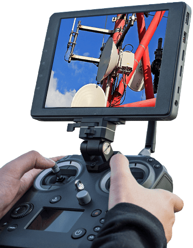
drone LiDAR remote

RTK Platform + Survey-Grade LiDAR Payload:

  • Integrated laser scanner with multiple-return capture - ground points recovered through grass, brush, and forest canopy
  • RTK/PPK positioning tied to your ground control - typically centimetre-grade on open ground, validated against control points on every site
  • Classified point cloud delivered in LAS/LAZ, plus bare-earth DTM, DSM, and contours at your interval
  • Georeferenced to your coordinate system and datum (UTM / 3TM / local as required)
  • Deliverables drop straight into Civil 3D, ArcGIS, QGIS, and common survey packages
  • Single mobilization can pair LiDAR with high-resolution imagery for a colourized cloud
  • Flown by Transport Canada-certified crew under our safety and compliance program

Exact sensor and platform selected per project. Contact us for the current LiDAR payload spec on your site.

Why sites trust UAV Imaging

Survey data only matters if it holds up under review. Our process is built on compliance, control, and repeatability.

Transport Canada Compliant

Every flight is run by a Transport Canada-certified crew under full regulatory compliance for commercial drone operations.

COR Certified + Insured

We are COR certified and fully insured, so we mobilize onto your site on the same safety footing as your other contractors. Certificates and documentation available on request.

ISN Member Contractor

As an ISN Member Contractor, our safety and compliance records are already verified for industrial procurement.

Need a Drone LiDAR Survey?
Rapid mobilization across Alberta - timing confirmed when you book.

How a Project Runs

1

Site orientation

Permits, airspace, and site safety coordination before anyone flies.

2

Control handoff

Your ground control and coordinate system tied into the flight plan.

3

Capture

Flight is typically completed in a day on site, without stopping your operation.

4

Processing + delivery

Deliverables processed and issued on a schedule confirmed per scope - ask when you book.

Drone LiDAR - Frequently Asked Questions

When should I choose LiDAR over drone photogrammetry?
Choose LiDAR when the ground is covered by vegetation or you need a true bare-earth surface. Photogrammetry maps what the camera can see, so grass, brush, and canopy show up as terrain. LiDAR's multiple returns reach the ground through gaps in vegetation, producing an accurate bare-earth model. For bare, open ground and most stockpiles, photogrammetry is usually faster and more economical.
What deliverables do I receive?
A classified point cloud (LAS/LAZ), a bare-earth Digital Terrain Model, a Digital Surface Model, and contours at your chosen interval - georeferenced to your coordinate system and datum, ready for Civil 3D, ArcGIS, QGIS, and common survey software.
How accurate is drone LiDAR?
Accuracy depends on flight parameters, ground control, and vegetation, so we quote it per project and tie every survey to real-world control points. We will confirm the achievable accuracy for your site and application before flying rather than quote a single headline number.
Where do you provide LiDAR surveys?
Across Alberta and Western Canada, including Edmonton, Calgary, Red Deer, and Fort Saskatchewan, with mobilization to remote sites for corridor, pit, and forestry work.
Do I need ground control points, or is RTK enough?
RTK/PPK positioning gets excellent results on its own, but ground control points remain the gold standard for review-ready accuracy. We recommend control for engineering deliverables and will confirm the right setup for your site and tolerance.
Does the season matter - leaf-on vs leaf-off?
LiDAR reaches the ground through gaps in vegetation, so leaf-off conditions give the densest bare-earth coverage under trees and brush. Leaf-on flights still work well; we advise on timing based on your site cover and what the data needs to support.
How quickly can you mobilize, and what safety documentation is available?
Mobilization depends on location and airspace, and is confirmed when you book. Insurance certificates, COR and ISN documentation are available on request for your procurement or safety team.

Ready to scope a LiDAR survey?

REQUEST A QUOTE

or call 587-532-9000

Related reading
LiDAR vs photogrammetry - which survey method fits your site →

A side-by-side on accuracy, vegetation, cost, and turnaround so you can pick the right tool before you book.

Call 587-532-9000Get a Quote