DJI Matrice 300 RTK
The DJI Matrice 300 RTK is UAV Imaging's primary industrial-grade aircraft — the workhorse that flies the majority of mapping, inspection, and stockpile work across Alberta. It is the most capable production multirotor DJI ships for commercial-industrial use: a 55-minute flight time, IP45 weather sealing, RTK-grade positioning, and a dual-payload bay that pairs the H20T (4K + 1200mm zoom + radiometric thermal + laser rangefinder) with optional secondary sensors.
At a glance
- Flight time: Up to 55 minutes per battery cycle
- Max wingspan: 895 mm (folded), 1,668 mm (props extended)
- Max takeoff weight: 9.0 kg
- Weather sealing: IP45 (protected from sustained rain and dust)
- Operating temperature: -20°C to +50°C
- Positioning: RTK GNSS, 1 cm + 1 ppm horizontal accuracy
- Wind resistance: 15 m/s (54 km/h) sustained
- Max service ceiling: 5,000 m (7,000 m with high-altitude propellers)
- Transmission range: 15 km (line-of-sight, OcuSync Enterprise)
Full specifications
| Aircraft | |
|---|---|
| Diagonal wheelbase | 895 mm |
| Empty weight (with batteries) | 6.3 kg |
| Max payload | 2.7 kg |
| Max takeoff weight | 9.0 kg |
| Max ascent / descent speed | 6 m/s ascent, 5 m/s descent |
| Max horizontal speed | 23 m/s |
| Max wind resistance | 15 m/s |
| Hover accuracy (RTK) | ± 0.1 m vertical, ± 0.1 m horizontal |
| Operating temperature | -20°C to +50°C |
| Ingress protection | IP45 |
| Positioning + GNSS | |
| RTK accuracy | 1 cm + 1 ppm horizontal, 1.5 cm + 1 ppm vertical |
| Constellations | GPS, GLONASS, Galileo, BeiDou |
| NTRIP compatibility | Yes — Alberta SmartNet, CanNet, third-party services |
| PPK support | Yes — raw RINEX log output |
| Battery | |
| Model | TB60 intelligent flight battery |
| Capacity | 5,935 mAh |
| Voltage | 52.8 V |
| Self-heating | Yes — required below 5°C |
| Charge cycles | 200 (manufacturer rated) |
| Transmission | |
| Protocol | OcuSync Enterprise |
| Range (FCC) | 15 km |
| Range (Canada / ISED) | 8 km |
| Video quality | 1080p / 30 fps live |
H20T payload — the standard pairing
UAV Imaging operates the Matrice 300 RTK with the DJI Zenmuse H20T as its standard payload. The H20T is a quad-sensor gimbal that combines:
- 20 MP zoom camera: 23-1200mm equivalent, 200x hybrid zoom — reads asset tags from 30 m altitude
- 12 MP wide camera: 24 mm equivalent for orientation imagery
- Radiometric thermal: 640×512 px, ±2°C accuracy, ideal for solar + electrical inspection
- Laser rangefinder: 3-1200 m, ± 0.2 m accuracy — measures structure dimensions from standoff
Secondary payloads operated alongside H20T on dual-bay configurations:
- DJI L1 LiDAR for vegetation-penetrating point clouds (paired flight, not simultaneous with H20T)
- Pergam Falcon methane sensor for natural-gas leak detection on pipeline + gas-coop surveys
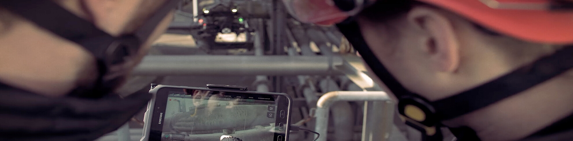
How UAV Imaging uses the Matrice 300 RTK
Mapping + stockpile work
Autonomous waypoint missions with 80/70% overlap, RTK or PPK positioning, 5-10 ground control points. A 50-hectare aggregate yard captures in 30-45 minutes including battery swap. See drone stockpile measurement.
Solar farm thermal inspection
H20T thermal payload at 30-50 m AGL. Identifies hotspots, bypass-diode failures, soiling patterns, and disconnect issues. Warranty-claim-grade radiometric thermal deliverables. See solar farm inspections.
Transmission + flare stack inspection
Zoom payload at 10-30 m standoff, hovering on RTK-grade hold. Captures corrosion, conductor strand damage, insulator wear, and fastener condition. See drone inspection services.
Methane detection
Pergam Falcon payload on autonomous grids over gas distribution. Detects methane plumes at ppm-m sensitivity. See the Alberta Gas Co-ops case study.
Certifications + compliance
- Transport Canada: registered, Advanced RPAS operations
- Remote ID: compliant via firmware (mandatory in Canada November 2026)
- Insurance: covered under UAV Imaging $5M aviation liability
- BVLOS: Level 1 Complex Operations capable — application active for pipeline + transmission corridors
Why this aircraft for commercial Alberta work
- Cold-rated to -20°C — operational through most Alberta winter
- IP45 sealing — flies in light rain and dust
- 15 m/s wind tolerance — flies on more days than light aircraft
- RTK positioning — cm-grade results without external base station in cell coverage
- Dual battery redundancy — single battery failure is not a crash
- Field-supportable — DJI Canadian dealer network keeps repair turnaround under 10 days